
|
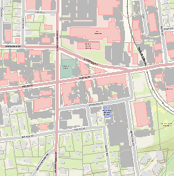
Interactive Carrboro Map | Don't know what you want? Start here. | |
|
Orange County Property Information | Looking for plats and other land records? Everything Orange County knows about your property--search by address and rummage around. | |
|
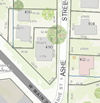
Find an Address | Where is an address? Who owns the property? What jurisdiction is it in? | |
|
Set up a Mailing | Can I download addresses for a mailing to adjacent properties? | |
|
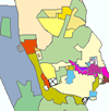
Zoning Map | What zone is a property in and what does that mean? | |
|
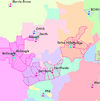
City Schools (Chapel Hill Carrboro City Schools) | What school district am I in? | |
|
Trash Pickup | When is my trash picked up? | |
|
Report Flooding | Have you had flooding on your property? Report it here! | |
|
See Flood Reports | Where have people reported flooding in Carrboro? | |
|
Floodplain | Is my property in a floodplain? I need an elevation certificate. (Get that here) | |
|
Data Download | Can I get GIS data to use in my own mapping? | |
|
Maps to Print | Can I just print or view a .pdf map? |